Tropical Storm Emily: She came in the night – with howling winds and torrents of rain and this morning although it continues to rain it certainly seems like the worst is over, so what exactly is happening now and what can we expect for the next few days?
Before I continue, for anyone who may be out of the country and worrying about their Casa de Campo villa – you can stop worrying. Obviously, I can’t say what it’s been like in other parts of the country but here in Casa de Campo La Romana, it’s honestly not been that bad. Yes it rained and was windy in the night and yes it is still raining – but nothing out of the ordinary. In fact, I would say (and this is just my opinion) the weather was less worrisome than during a normal thunder storm – there was little/no thunder and lightening, which meant I could sleep without a problem!
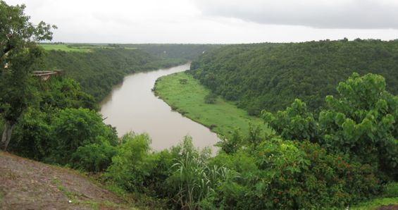
So did Tropical Storm Emily leave already?
For the answer to this question please consult the above photograph – does it look like she left? At 6am this morning the Dominican Weather Office (ONAMET) published an advisory which said ‘CENTRO DE EMILY PROXIMO A SALIR DE LA COSTA SUROESTE DE LA ISLA’ (the centre of Emily has no left the south coast of the Dominican Republic). Unfortunately, the giant, approximately 400 mile wide cloud which makes up Tropical Storm Emily is rather stubbornly sat on top of the Dominican Republic right now, which basically means that no, she didn’t leave yet.
Oh no! So what does that mean for us? Rain. Just like all clouds or at least nearly all clouds, the cloud that is Tropical Storm Emily is going to keep dropping rain on the Dominican Republic. The good news is that it probably won’t get very windy and the rain should abate (slow down at least) within the next 24 hours as she moves up towards Cuba.
The Weather Outlook – uh oh it looks like rain!
Here is the 10 day weather forecast for La Romana:
Although this does look rather gloomy – notice the difference between today’s weather outlook (rain/thunder/wind) and the outlook for the rest of the week (scattered T-storms). What that basically means is that today it will rain all day, but then after than the weather will largely return to normal for this time of year – with some sunshine and a high chance of thunderstorms.
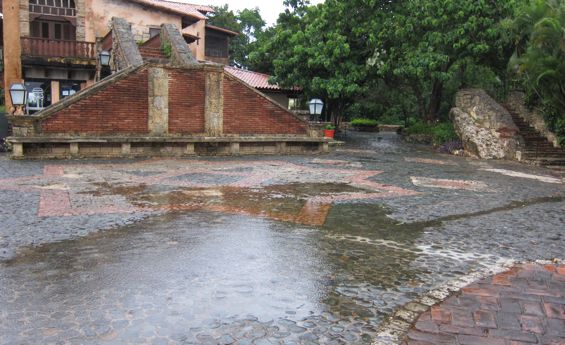
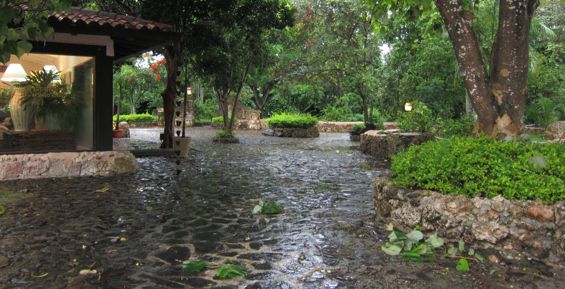
And in case any of you are still worrying, here are some photos I took this morning (literally half an hour ago), which show the ‘damage’ or rather the utter lack of damage to Altos de Chavón in Casa de Campo La Romana:
A puddle outside La Piazetta restaurant in Altos de Chavón
Tree ‘damage’ outside the Emilio Robba store in Altos de Chavón – what do you mean you can’t see anything? I can see at least 4 piles of leaves on the ground!
For the MOST up-to-date information, follow the storm using the following websites:
ONAMET.gov.do – the Dominican Republic’s official weather warning people (this one is in Spanish)
Twitter: We recommend following NHC_Atlantic – for regular tweets on Tropical Storm Emily’s progress.
This article was written by Rebecca Hughes, editor of Casa de Campo Living and Casa de Campo’s entertainment specialist!
Rebecca Hughes, Editorial and Events Marketing
rhughes@casadecampoliving.com
TEL: 809-523-2045 CEL: 809-949-8906
BBM: 230DA5D1
Altos de Chavón, Casa de Campo


